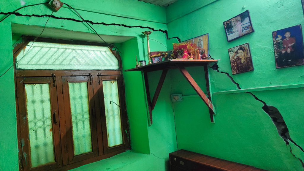


These disturbing images are from Joshimath – a holy town in Uttarakhand.
As you can see, cracks have appeared in buildings, roads, and all civic infrastructure.
At the time of writing this report, about 700 families have been evacuated and more evacuations are being planned.
What is happening is that, quite simply, land is sinking. This means that all construction on top of that land is unsettled.
You might have observed such cracks after massive earthquakes.
But Joshimath has not had a major quake this week. So, why are these cracks appearing, and so fast?
The answer is not simple. There are multiple factors at play here.
Reason One: Land Subsidence
Land subsidence simply means the sinking of the ground. But why does the ground sink?
This video by a Taiwanese scientist (English captions) will help us understand the process.
Joshimath is in the mountain regions – on a slope of sorts. So, it is fair to expect a very high level of groundwater.
The load bearing capacity of land which has high groundwater content is low. Rocks can bear weight easily. (You may want to try a similar experiment in your house, replacing model houses with weights to see what kind of land will carry more construction weight).
Reason Two: Landslide Zone and Fault Line
Joshimath is located on the site of an earlier landslide. This means that, along with high water content, the soil itself is not mountain rock, but the loose soil of a landslide.
Secondly, Joshimath is located on an existing fault line in Seismic Zone 5 (Seismic Zone 5 means highest level of earthquake activity. Here, earthquakes can happen often and their severity is also high). In the image below, which was tweeted by @Starboy2079, we can see the line that indicates Tapovan fault line.

Reason Three: Construction
Being a place of religious significance, many hotels popped up in this small town. Notice this image, also tweeted by @Starboy2079, that shows us the level of construction on the location.

This satellite image of Joshimath also shows us the construction activity and its expanse.

Reason Four: Tunneling, Dams, and other human activities
Two years ago, in February, this region saw a flash flood.
Some people have blamed the tunneling and damming activity for the destruction of the delicate ecosystem.
The Mishra Committee Report, 1976
In May 1976, Shri MC Mishra, then the Commissioner of Garhwal (this area was, at that time, in Uttar Pradesh), had commissioned a 5-day survey of the land from May 10-15, 1976.
The members of the Committee were from various departments and units.
This Committee had warned against tunnelling and extensive construction in the area, and had mentioned that the area might sink.
However, the report was never acted upon.
Other places where this has happened
Jakarta is one of the worst affected global cities. Which is why the Indonesian government has decided to create a new capital city. Beijing, the US, Japan, and other places.
And Delhi:
This video explains the geology of land subsidence in greater detail.