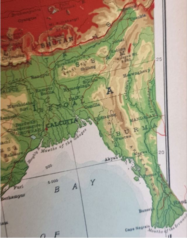
In 1923, America got its first indigenously made atlas. What you see on the right is a snippet of the map of India from that atlas. If you see carefully, to the east of the Bengal province (this was the entire Bengal before the partition of India), there are 2 more provinces – in the north is Assam, and under that is Burma (In 1923, Burma was an inseparable part of India. It is now a country called Myanmar).
All the 7 sister North East states that we know today were, at one time, a part of a single state – Assam.

Burma was a part of India till 1934.
Here is an encyclopedia entry on Assam from the Columbia Viking Desk Encyclopedia, 1953.

Over a period of time, the states of North East India were created from Assam.
Nagaland was the first state to be created in 1963, followed by Meghalaya, Tripura, and Manipur (all three on 21st Jan 1972), and then Mizoram and Arunachal Pradesh (on 20th Feb 1987).
In some cases, the states don’t agree on the borders between them. There is even a No Man’s Land between Assam and Mizoram. (No Man’s Land is an area between two borders over which both parties don’t hold control. Such land is often not used in any way and is monitored by both sides.)
Assam has border disputes with Nagaland, Meghalaya, Mizoram, and Arunachal Pradesh. These disputes do not disturb the normal lives of people. They come to the fore from time to time because of some incidents.
There is also a border dispute between Tripura and Mizoram.
Why do these disagreements happen?
These disagreements can happen because of one or more of these reasons:
A. The tribal areas feel that some areas belong historically to their tribes and should belong to the state that is theirs.
B. Sometimes (as in the case of Assam – Mizoram border), there is more than one treaty to effect the division of a state into two. Obviously, there will be a difference in borders in the two treaties. Mizoram wants to follow the older treaty (1875), which gives it more land, while Assam wants to follow the newer notification(1933).
C. There is a sense of using the land that belongs to one state by residents of another state. In this case, the Mizos feel that illegal Bangladeshi immigrants are building inside Mizo state, and want to stop that. This is also one of the reasons for the current fight.
What is currently going on at the Assam – Mizoram border?
Since October 9th, there have been some fights between Assam and Mizoram on the state borders. Both sides feel that the other state is taking their territory away. The Mizoram and Assam Chief Ministers are working with the Home Minister of India to work out the dispute.
An effort is being made to resolve them peacefully and permanently.
Is this the first time that this is happening?
Not at all! Since its formation in 1963, Nagaland has been asking for some territories that it believes belong to it historically.
All the states that have these border disagreements have had incidents like this in the past. The incidents are always resolved in a short time.
What is different this time is that many states are talking to each other at the same time to try and resolve their differences.
In September 2020, Assam and Nagaland held high level meetings to resolve the issue. BJP Party members in Meghalaya have written to the central govt to start a permanent solution process to the Assam – Meghalaya dispute, and the Assam -Mizoram dispute is already being discussed at the highest levels.
We hope that this brings lasting peace to one of the most beautiful parts of India.