Powerful Nature Reigns!
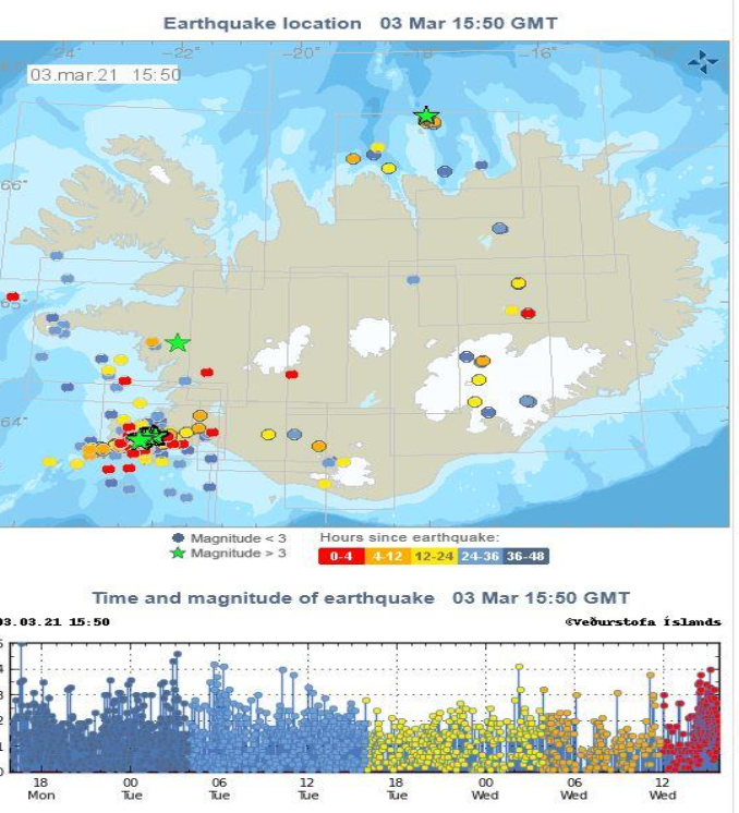
Iceland, Mar 4: Iceland is a volcanic island used to occasional tremors. However, since the previous week the land has experienced an unusual amount of earthquakes – around 17,000 in a stretch! It was continuous shaking of land for 24 hours every day for a whole week. It has affected the southwestern region of Iceland near the capital city, Reykjavik. The largest quake was felt on February 24 with a magnitude of 5.6 on the Richter scale. Two large quakes of magnitude greater than 5.0 also hit the island on February 27 and March 1. The Icelandic Meteorological Society and volcanologists are constantly monitoring the tremors and saying that a potential eruption was detected near Mount Keilir. The magma is fracturing and has come close to the surface causing the eruption. Since Iceland is sitting on a tectonic plate boundary that continually splits apart, pushing North America and Eurasia away from each other, it faces continuous tremors.
