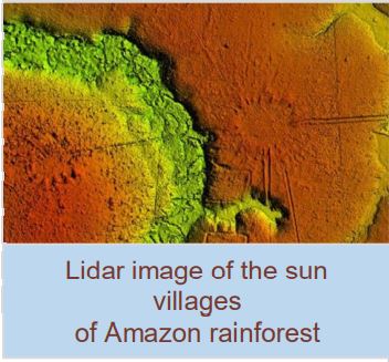
An international group of researchers teamed up to survey the area of the Brazilian state of Acre with LIDAR (LIght Detection And Ranging), a technique where billions of lasers shot from a helicopter penetrate the rainforest’s canopy and map the landscape below.
The LIDAR survey, along with satellite data, showed an amazing 25 circular mound villages and eleven rectangular mound villages connected by road networks. These villages and road structures have probably been around since the 14th century.
The round villages had elongated mounds circling a central plaza, like marks on a clock. The elongated mounds, when seen from above, look like the rays of the sun, giving the common name of sóis, which means suns in Portuguese.

Photo by David Riaño Cortés
The arrangement of mounds in a specific pattern resembles stars arranged in the cosmos. The area is believed to be the home to a variety of soil-engineering cultures.

