Michigan, Jul 6: Scientists from the University of Michigan have developed an innovative way to track the movement of tiny pieces of plastic in the ocean. For this they will be using NASA’s satellite, named Cyclone Global Navigation Satellite System (CYGNSS). It is a group of 8 satellites that measures wind speed and provides information about hurricanes (large rotating storms with high speed winds usually formed over warm water areas).
NASA’s CYGNSS radar also measures ocean roughness, which can be due to wind speed or debris in water. Researchers looked for the areas where water seemed smoother than normal. At these places they expected presence of microplastics. Then they compared these areas to observations, and model predictions of where microplastics gets accumulated in water. Their speculation was right, and thus researchers discovered microplastics tend to be present in smoother waters and CYGNSS could be used to detect ocean wastes.
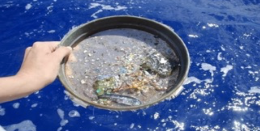
Microplastics form when plastic trash in the ocean breaks down from the sun’s rays and the motion of ocean waves. These small flecks of plastic are harmful to marine organisms and ecosystems. Till now, the main source of information about location of microplastics was fisher boats that venture out to catch fish, and unintentionally pick up microplastics.
–News inputs by Aryaa Sinha
