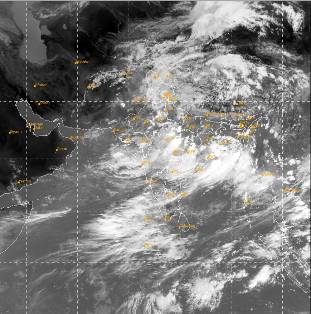
The monsoon season in India sustains the bulk of Indian agriculture. Therefore, it is, justifiably, the most awaited season.
This season also leads to flooding in many parts of the country.
Some areas currently experiencing floods are:
Himachal Pradesh
Flash floods in the Bagipul region of Mandi district, Himachal Pradesh.

Kullu Manali National Highway is blocked.
The weather warning of IMD predicts five more days of rain in the region. Two of these are days of heavy rain. This means that relief and rescue efforts are likely to be hampered because of the weather.
Jammu and Kashmir
The Jammu Srinagar National Highway remains blocked due to rains and flooding.
The district administration of Ramban has ordered closure of all schools up to grade 10 on account of the rains.
Assam
Assam, through which the mighty Brahmaputra river flows, experiences heavy flooding every monsoon season.
This year as well, about four lakh people have been impacted by the floods. The flood remained for three days. While the water has started receding now. About 1.7 lakh people are still impacted.
19 out of 35 districts are still flooded.
This map, from the Indian Met Department website, indicates all the districts that have received surplus rainfall in the week 15 – 21 June 2023.

According to Google maps, the current “Above Normal Flood Alert” zone is this:

Mumbai
Mumbai received exceptionally heavy rainfall with the onset of monsoons. Accordingly, many parts of the city experienced flooding.
Over the next few days, more rainfall is expected on the Konkan coast, and flooding might be experienced in the coastal regions of Maharasthra and North Karnataka, according to IMD.
Uttarakhand
Uttarakhand received an orange alert from IMD for some of its districts. Heavy flooding was seen in Haridwar on the very first day of monsoons. The state will monitor and manage floods. A new warning system is being used this year.
This year also marks the 10th anniversary of Kedarnath floods.
Weather Forecast for 26th – 27th June
Weather Forecast and Warning for rest parts of the country due to strengthening of the Southwest Monsoon Flow over the Indian subcontinent:
❖ The Low Pressure Area now lies over north interior Odisha and adjoining south Jharkhand & north Chhattisgarh. It is very likely to move west-northwestwards towards north Madhya Pradesh during next 2 days.
❖ An east-west trough runs from northwest Rajasthan to Northeast Bay of Bengal in lower tropospheric levels.
❖ An off-shore trough at mean sea level runs from south Gujarat coast to Kerala coast.
East & adjoining Northeast India
❖ Fairly widespread to widespread light/moderate rainfall with isolated thunderstorm & lightning very likely to continue over the region during next 5 days. ❖ Isolated Heavy to Very Heavy falls very likely over Odisha on 26th; over Assam & Meghalaya, Arunachal Pradesh on 29th & 30th June. Isolated heavy rainfall also likely over parts of East India during next 2 days and over northeast India during next 5 days.
Northwest India
❖ Light/moderate fairly widespread to widespread rainfall with isolated heavy falls very likely over Western Himalayan Region and over the plains of northwest India during next 5 days.
❖ Isolated Heavy to Very Heavy rainfall with Extremely Heavy Falls very likely over East Rajasthan on 29th June, heavy to very heavy rainfall on 26th, 27th & 28th June.
❖ Isolated heavy/heavy to very heavy rainfall very likely over Uttarakhand, Himachal Pradesh on 26th & 27th; over West Uttar Pradesh on 26th June.
Central India
❖ Light/moderate fairly widespread to widespread rainfall with isolated heavy/very heavy falls, thunderstorm & lightning over the region (Madhya Pradesh, Chhattisgarh & Vidarbha) during next 3-4 days.
❖ Isolated extremely heavy rainfall very likely over Chhattisgarh on 26th; East Madhya Pradesh on 26th & 27th; West Madhya Pradesh on 27th & 28th and over Vidarbha on 27th June.

