First of its kind survey on land animals
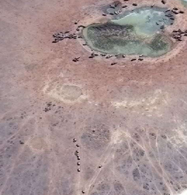
London, Jan 24: UK based researchers have counted elephants using satellite cameras and artificial intelligence (deep learning methods). They have scanned the African forests and grasslands and captured high resolution images from the satellite, Worldview 3. The images were processed using an algorithm developed by Dr Olga Isupova, a computer scientist at Bath University. This led to an accurate count of African elephants in the wild.
Previously, human observers used to count individual animals from low flying aircraft. But this latest technique was useful because vast areas of land could be scanned in a matter of minutes. It was also more accurate.
It is the first time that the technique has been applied in a
heterogeneous landscape – mixed landscape of open grassland,
woodlands, and partial vegetation coverage. They have also
selected African elephants, the largest land animal, so that
spotting from space is easy. Before this, whales have also been counted using this method. With advances in technology, we may be able to count smaller species too.

elephants Credits:blog.hexagongeospatial.com