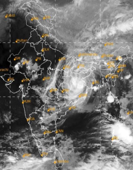
Delhi, May 26: The image on the right is the satellite image of Cyclone Yaas at 2200 hours IST, released by the Indian Met Department. The eastern coast of India sees cyclones frequently at this time of the year. Cyclone Yaas is the most recent.
Yaas was formed as a low-pressure area and developed into a cyclone. It was first spotted by Indian Meteorological Department on May 23rd. The cyclone originated near the Andaman Islands and then travelled north-westwards.
The cyclone started its landfall on the Odisha coast at about 0900 hours. After landfall, a cyclone starts to weaken. This cyclone also weakened from a ‘very severe’ to a ‘severe’ cyclone. The cyclone will now travel towards Jharkhand and will continue to weaken. By tomorrow morning, it will become a low- pressure region and then completely vanish.
Preparedness
The National Disaster Response Force (NDRF) had stationed (placed) 113 teams in Jharkhand, Odisha, West Bengal, Andhra Pradesh, Tamil Nadu, and Andaman and Nicobar Islands.
The state governments also made their own preparations. The Coast Guard, Indian Navy, Army, and other units were also on standby to offer their services if needed. 20 lakh people were evacuated (taken to safer places) in Odisha.
Since the cyclone has now passed, Odisha and Bengal governments are working on relief for their citizens. The cyclone also caused damage in Bangladesh.
This report has been written by Amey Haldankar
