One Of The Oldest Maps In Europe
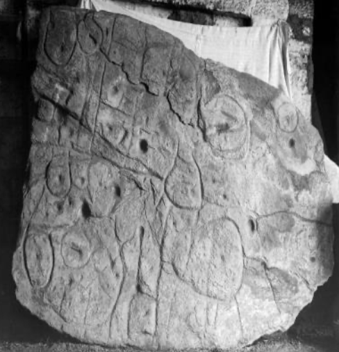
France, Apr 8: Archaeologists recently studied the patterns engraved on on a stone that is around 4,000 old. The slab was first uncovered in 1900 and left unattended for years, and was studied only in 2014. It is two metres by 1.5 metres in size with marks and engravings of repeated motifs (a pattern or design) joined by lines depicting an area of western Brittany in France. The researchers say that the indentations are a 3D representation of the Odet River Valley in Finistere, on Brittany‟s northwestern tip. The motifs may represent the location of settlements, barrow (circular enclosures of earth or stone) sites, and field systems in that area. The territory represented on the slab was 80% accurate to an area of around eighteen mile long stretch of the river. This is the first time a map has depicted an area on a specific scale and considered to be the oldest map in Europe.
